Maps of Chickamauga
Map Legend
The Battle
The Campaign
Sept. 18th, 1863
Sept. 19th, 1863
Sept. 20th, 1863
Then and Now
Order of Battle
Monuments
Wargaming Chickamauga
Conclusions
Bibliography
|
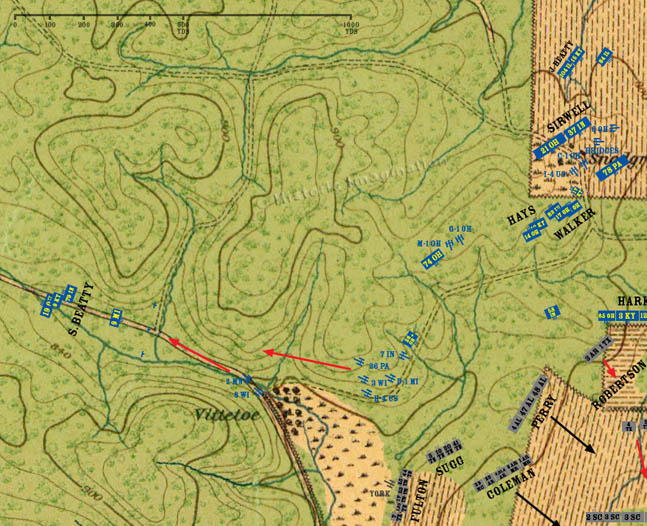
12:10 PM
Horseshoe Ridge
Sept 20th
By now the spur on Snodgrass Hill has collected several batteries of artillery as well as stragglers from several regiments and brigades. In addition, many ammunition and supply wagons not shown on the map are at the bottom of western slope of the hill. These wagons belong to many of the units fighting at Kelly Field.
Fulton’s brigade crests a ridge overlooking the Vittetoe farm. Next to the farm, the Dry Valley Road runs through a gorge on the way to McFarland Gap. Fleeing Union troops clog the road, and the gorge acts as a natural bottleneck. Fulton calls up York’s Battery, and it shells the gorge. The cannon fire causes a panic and stampede in the already routed Federals. Sugg’s brigade links back up with Fulton.
To the north, the remains of the artillery batteries from the ridge make their way northwest through the woods. However, a remnant of the 26th Ohio, and several cannons of the 7th Indiana Battery rally and make a stand in the woods. |
|
|