This map shows Cockspur, McQueen's, and Big Tybee Island. The Federal batteries located along the length of western Big Tybee Island converged their fire on Fort Pulaski. This concentrated fire battered the the walls of the brick and masonry fort until one corner collapsed. |
|
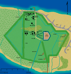
| This map shows Fort Pulaski on Cockspur Island, along with the surrounding outbuildings and important terrain features. |
|
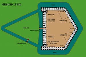
Map of the lower level of Fort Pulaski. |
|
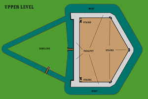
| Map of the upper level of Fort Pulaski. |
|
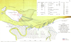
| Map of the area of battle from General Gillmore's official report. |
|
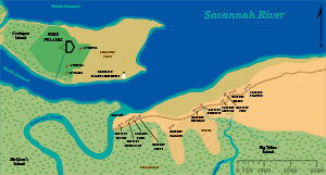
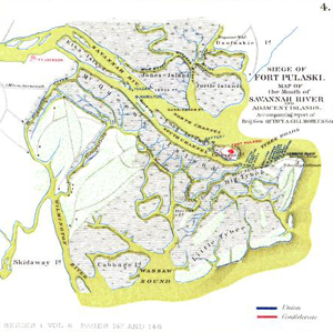
| Map of the area of operations near the mouth of the Savannah River from the Official Records. |
|
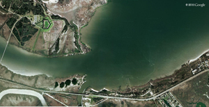
| Modern satellite image of Cockspur, McQueen's, and Big Tybee Island. On Big Tybee Island the shore line from Goat Point eastward has eroded and changed. The construction of Highway 80 and the bridge connecting McQueen's and Big Tybee Island destroyed the site of the Federal batteries at Goat Point. Image © Google 2010. |
|
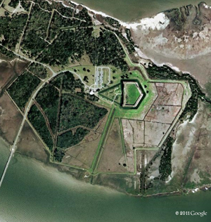
| Modern satellite image of Cockspur Island and Fort Pulaski. Image © Google 2010 |
|