|
Maps of Allatoona Pass The Battle Then and Now |
Then and Now
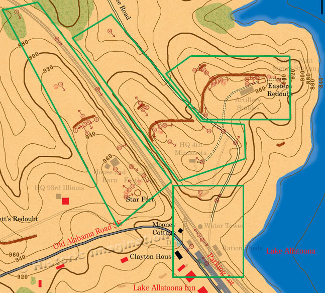
The Allatoona Pass battlefield is in an excellent state of preservation. The battlefield is on Army Corps of Engineer property with the exception of rifle pits south of the Cartersville Road and Rowett’s Redoubt, which are on private property. Portions of Rowett’s Redoubt still exist, but a house now stands right at its apex. All other rifle pits are also on private property and likely destroyed. The biggest change to the battlefield is the growth of trees. At the time of the battle, the defenders removed all of the trees in the surrounding area to provide fields of fire. Now, the entire battlefield is under forest cover. Fortunately, trees actually help preserve Civil War earthworks. The roots and undergrowth provide an anchor that helps slow the erosion of trenches. The modern photographs in this section were taken during the winter to show the minimum amount of foliage and provide a better view of the terrain. The map below is divided into four sections. It shows modern changes to the battlefield, but I have left the treelines the way they were during the battle to keep the feel of the 1864 terrain. Simply click on a section to view the pictures in that area.
 |
|
All images, text, and video © Historic Imagination Optimized for viewing at 1024 x 768 or better |
||