|
Maps of Allatoona Pass The Battle Then and Now |
Modern Changes
The map below illustrates most of the changes that have occurred on and near the battlefield since 1864. The most prominent, of course, is the creation of Lake Allatoona. The railroad bed south of the pass appears to have been raised slightly in order to make an earthen dam. The contour lines on the map were not changed to reflect this. The Western & Atlantic Railroad, now CSX, was moved in the 1940s because of the creation of Lake Allatoona. Trees and forest now cover most of the battlefield, which was open at the time of the battle to provide the defenders with clear fields of fire. A modern paved road, Old Alabama Road, has taken the place of the Cartersville Road. The western portion of the Cartersville Road now serves as a communal driveway for several houses in the area. Several houses have been built west of the Star Fort, and Rowett’s Redoubt is in danger of being destroyed. No effort was made to place every single house, structure, and driveway on the map, but a good idea of how the area has changed can be seen. 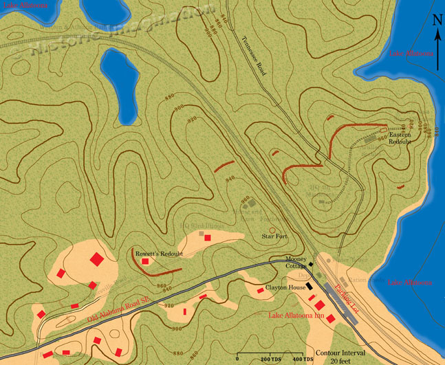 Larger Image 533k |
|
All images, text, and video © Historic Imagination Optimized for viewing at 1024 x 768 or better |
||