|
Maps of Allatoona Pass The Battle Then and Now |
The Map The map below shows the terrain and battlefield around Allatoona Pass on October 5th, 1864 without the military units. Use it as a basic map for understanding the terrain around the battlefield, or print it out and use it to explore the battlefield in person.
By October 1964 most of the trees had been cleared from the hillsides surrounding the Railroad Cut and Allatoona village to provide the defenders clear fields of fire. However, there were still varying amounts of underbrush along the hillsides and gullies. Be sure to visit the map legend for an explanation of the map symbols. 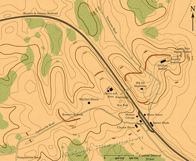 |
|
All images, text, and video © Historic Imagination Optimized for viewing at 1024 x 768 or better |
||